Long Meg and Her Daughters Stone Circle, Cumbria – Part Two

Long Meg and Her Daughters - 3D view of Long Meg

Long Meg and Her Daughters – 3D view of Long Meg

This post is concerned with the photogrammetric survey strand of survey that we undertook (see first post) as part of the Altogether Archaeology project at Long Meg and Her Daughters stone circle near Penrith, in the Eden Valley, Cumbria.

In this instance we undertook to photograph 33 of the 69 individual stones consisting the stone circle, and including the Long Meg monolith itself. This process was undertaken by the Altogether Archaeology volunteers who photographed each individual stone from the ground, and by taking shots from above using a photographic mast. The intention was to take photographs from all around the stones so as to provide complete overlapping coverage of each individual stone. The background detail needed to be removed from each photograph and this was achieved both by masking it out on the computer and by having a white background held behind the individual stones during photography.

Long Meg and Her Daughters - photographic recording in action

Long Meg and Her Daughters – photographic recording in action

Altogether Archaeology volunteers were instrumental in going through the various processes using Agisoft Photoscan Pro software to produce nine 3D models of individual stones from the circle. The software combined the photographs, computed the positions that the images were taken from, generated a 3D mesh, and then the photographs were reapplied to the 3D mesh as a texture.  Each individual photograph needed to be prepared, and this entailed masking out of any background detail still left in the photographs, and then the application of survey control. The end product was a series of 3D models that can be viewed as 2D plans or within Adobe Acrobat as 3D pdf files.

Long Meg and Her Daughters - 3D stone

Long Meg and Her Daughters – 3D stone with control points

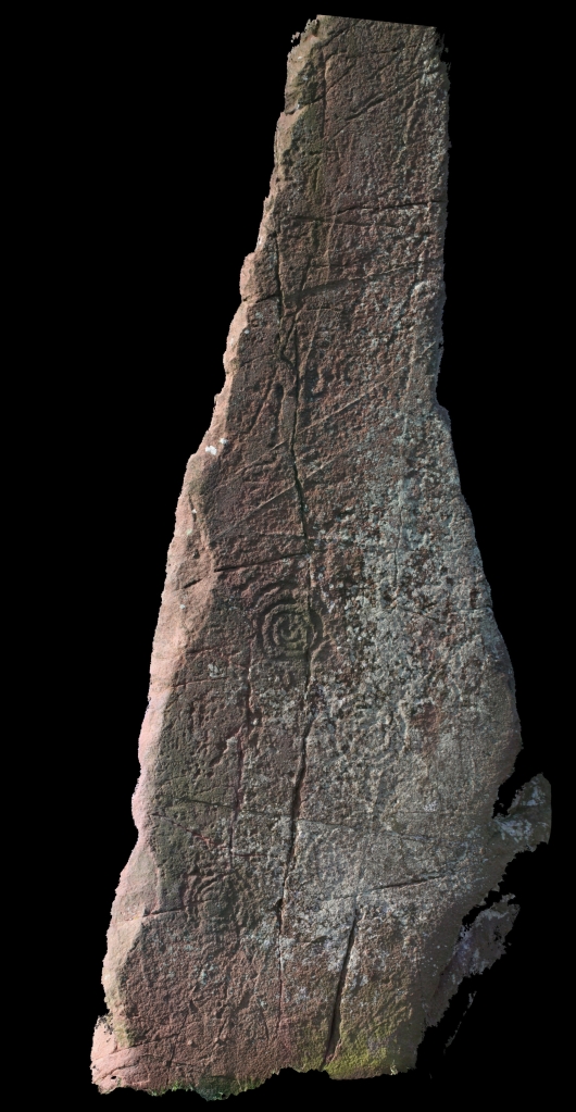
The photographs of the Long Meg red sandstone monolith came out particularly well as the bright sunlight slanted across the face of the stone containing the rock art motifs and gave sharp definition to the rock strata and any depressions in the surface.

Long Meg and Her Daughters - rock art motifs

Long Meg and Her Daughters – rock art motifs

Again many thanks must go to all of the Altogether Archaeology volunteers who braved the weather to take the photography on site, and to those luckier souls who were based in the nearby village hall processing the data.

Long Meg and Her Daughters Stone Circle, Cumbria – Part One

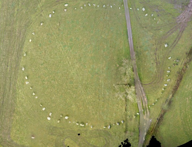
Long Meg and Her Daughters - Plan View

Long Meg and Her Daughters – 2D Plan View

Earlier in the year we were commissioned by Paul Frodsham of the North Pennines AONB under the guise of the Heritage Lottery funded Altogether Archaeology project to undertake two types of photogrammetric survey at Long Meg and Her Daughters stone circle located in the Eden Valley, near Penrith, Cumbria. This was part of a wider community project to develop an understanding of this exceptionally important monument and provide detailed surveys and geophysical investigation of the monument.

The work was undertaken in March 2013 and this post is concerned with the first part of our input into the investigation, which was producing a detailed aerial photographic plan of the site using a quadcopter UAV (Unmanned Aerial Vehicle).

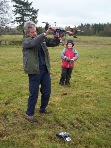
Setting up the Quadcopter

Setting up the Quadcopter

This method uses aerial photographs taken from a small electrically powered model helicopter (UAV) which has the ability to carry a light weight camera and has the advantage that it can take photographs from much lower altitudes than can legally be achieved with a light aircraft. Survey control was introduced to the photographs by the placement of survey control targets across the site which were located by means of a survey grade GPS.The photogrammetric processing was undertaken using Agisoft software that provides detailed modelling using the overlap of up to 150 photographs, and creates a very detailed DTM (Digital Terrain Model) across the site. The photographs were then digitally draped over the model to create an accurate 3D model of the ground surface.

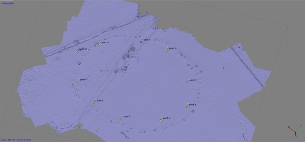
Long Meg and Her Daughters - Solid 3D oblique view

Long Meg and Her Daughters – Solid 3D oblique view

The primary output, however, was an accurate flat two dimensional image which can be used to generate accurate plans of surface archaeological features and contours across the extent of the site (at the top of the post). However, the 3D model can also be output as a tool to visualise the site from any perspective and can be viewed in more recent versions of Adobe Acrobat as a 3D pdf file.

Long Meg and Her Daughters - 3D Oblique View

Long Meg and Her Daughters – 3D Oblique View

Many thanks should go to all of the Altogether Archaeology volunteers who turned up in the cold weather to work on site during the project.