Surveying Longhouses and Shielings in the Duddon Valley

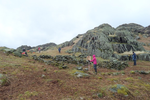
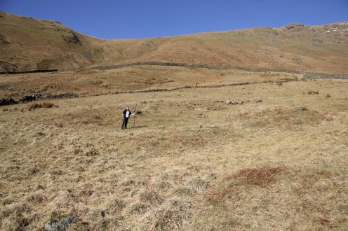
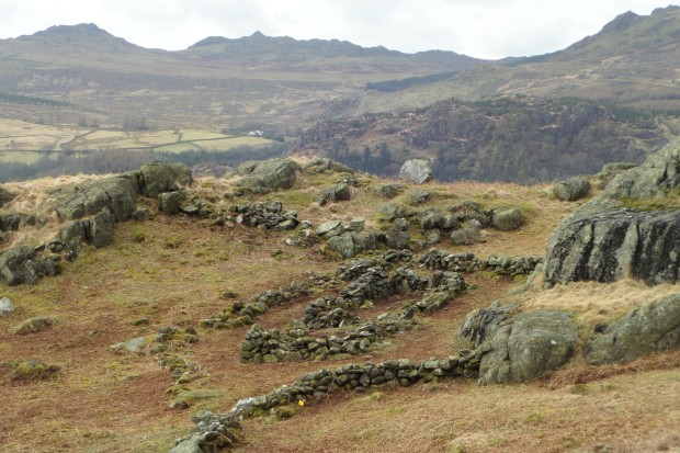
The domestic structure and surrounding walling at Tongue House High Close A

The domestic structure and surrounding walling at Tongue House High Close A

I’ve been lucky to be involved over the last week or so with some preliminary survey work that OA North have been undertaking to assist the Duddon Valley Local History Group (DVLHG) with their ongoing investigations of a series of potentially medieval period longhouse and shieling settlement sites in the upper reaches of the Duddon Valley.

The group have been successful in a Heritage Lottery Fund bid for the Duddon Valley Medieval Longhouse Project to further investigate and then selectively excavate at several of these sites to build upon previous surveys and investigation undertaken between 2011 and 2013, and OA North will be providing professional expertise to assist DVLG in this project over the next few years.

We shall initially be concentrating at three probable domestic sites located in the rough upland pasture intakes on the east side of the Duddon Valley, with two separate examples at Tongue House High Close and one larger enclosure/farmstead with two longhouses at Longhouse Close.

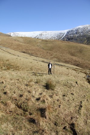
Wintery conditions surveying at Tongue House High Close A

Wintery conditions surveying at Tongue House High Close A

As part of the project I am teaching detailed topographic recording along with helping out with various other strands of preliminary investigation, from UAV drone survey of the wider landscape surrounding the sites through to geophysical and palaeoenvironmental investigation. I will post some more detailed findings as we continue through the project.

A survey training day in Bannisdale, in the Lake District

A bitterly cold surveying day in Bannisdale

A bitterly cold surveying day in Bannisdale

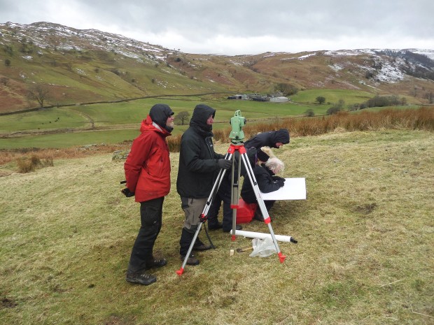
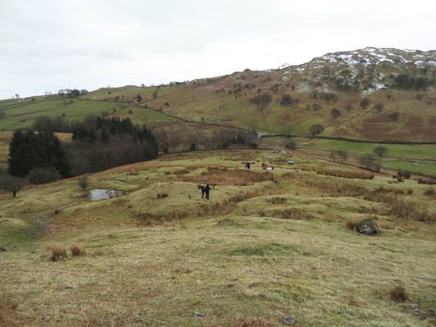
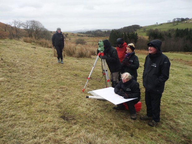
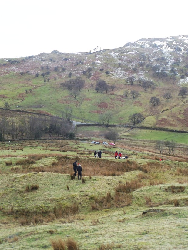
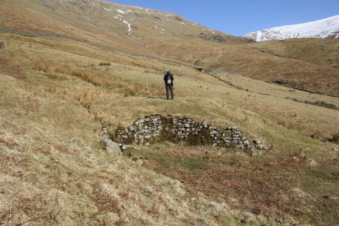
Today was mostly spent shivering in the icy wind blowing through Bannisdale in the Lake District. I was instructing volunteers from the Lake District Archaeology Volunteer Network in the dark arts of surveying archaeological earthworks. The site in question was an enclosed hut circle settlement at Lamb Pasture that is scooped into the hillside on the north side of this small relatively isolated Lakeland valley. The site is a scheduled monument and as part of ongoing management and conservation works  the Lake District National Park Authority require detailed surveys (which the volunteers will in future undertake) of this and other similar vulnerable sites.

Lamb Pasture enclosed settlement in Bannisdale

Lamb Pasture enclosed settlement in Bannisdale

Cold cold volunteers

Cold cold volunteers

Surveying at Lamb Pasture enclosed settlement in Bannisdale

Surveying at Lamb Pasture enclosed settlement in Bannisdale


Windermere Reflections – Industrial Archaeology publication

Cover of the popular publication for the Windermere Reflections Project

Cover of the popular publication for the Windermere Reflections Project

The popular publication we produced for the Windermere Reflections project has now come back from the printers.  It will shortly be available to purchase directly from the Lake District National Park Authority. Whether you are interested in community archaeology, industrial archaeology or the history of Windermere and the wider Lake District in general it is worth having a look at.

The book concentrates on the surveys and excavation undertaken in the Windermere catchment over the last few years as part of a Heritage Lottery funded project. Themes covered in the publication include metal mines, slate quarries, bloomeries, fulling mills and woodland industries. There is even a picture of me on the back!

Hexacopter UAV and Agisoft used to survey spoil tips at Greenside Lead Mines

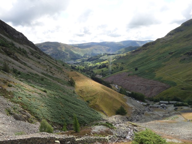
View down the valley overlooking Tip 1 and the lower working areas at Greenside Lead Mines

View down the valley overlooking Tip 1 and the lower working areas at Greenside Lead Mines

At the end of July we were commissioned by the Lake District National Park Authority to undertake topographic survey of the three large spoil tips at the extensive Greenside lead mining complex near Ullswater in the Lake District. Archaeologically the site is of national importance and is protected as a Scheduled Monument. Future management of the property necessitated the present detailed topographic survey in advance of engineering works to maintain the stability and structural integrity of the large spoil tips. The buildings beneath the spoil tips are currently used as hostel accommodation.

Tip 1 precariously sat above the youth hostel at Greenside Lead Mines

Tip 1 precariously sat above the youth hostel at Greenside Lead Mines

Normally such a detailed survey, requiring close contours for the extensive complex would take an inordinate amount of time to survey using traditional survey techniques such as Total Station or even differential GPS.  Over the last few years we have been developing more rapid and cost-effective survey capability using various unmanned aerial vehicles (UAV) to photograph archaeological sites, which is combined with Agisoft software to create 3D models and contours of sites.

Preparations for surveying Tip 3 at Greenside Lead Mines with the hexacopter UAV

Preparations for surveying Tip 3 at Greenside Lead Mines with the hexacopter UAV

Part of the site was surveyed and excavated in 2003-4 in advance to engineering works on Spoil Tip 2 using traditional survey methods, but whilst that took a week or so to undertake the present UAV survey took a day of flying and setting in survey control to cover the entire mine complex.

Surveying at Greenside Lead Mines with our hexacopter UAV

Surveying at Greenside Lead Mines with our hexacopter UAV

The site was visualised in Agisoft as a digital terrain model in both solid form and also with the aerial photography draped over the top. The data from this model was used to create detailed contours of the earthworks at various scales which could then be used when drawing up the site.

Isometric view up the valley at Greenside Lead Mines - screen capture of a solid texture model in Agisoft

Isometric view up the valley at Greenside Lead Mines – screen capture of a solid texture model in Agisoft

Isometric view up the valley at Greenside Lead Mines - screen capture of a photo texture model in Agisoft

Isometric view up the valley at Greenside Lead Mines – screen capture of a photo texture model in Agisoft

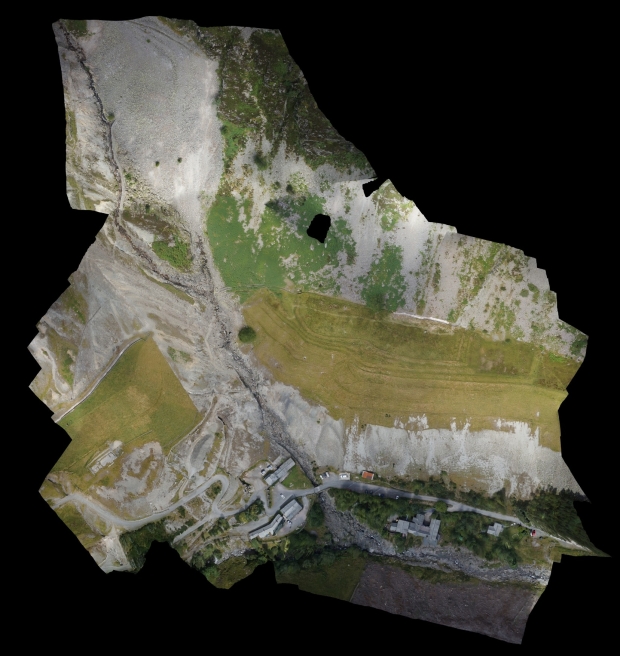
The complete site was also output as a single flattened scaled composite image which was then annotated in the field to add in the finer detail of archaeological structures and provide hatchures to the topographic survey.

Agisoft xy topographic plot of Greenside Lead Mines

Agisoft xy topographic plot of Greenside Lead Mines

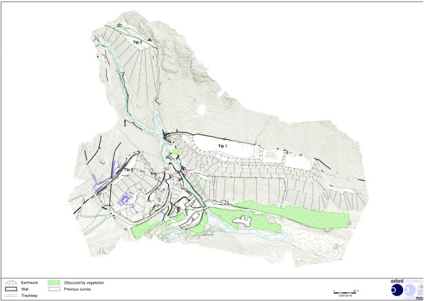
The finalised site drawings, contours and survey detail were then compiled into a single CAD drawing for the entire complex and figures created showing both the entire complex and detailed ones of specific features in the complex.

Finished topographic survey of Greenside Lead Mines

Finished topographic survey of Greenside Lead Mines

Detail of the topographic survey between Tips 1 and 2 at Green side Lead Mines - no photo

Detail of the topographic survey between Tips 1 and 2 at Green side Lead Mines – no photo

Detail of the topographic survey between Tips 1 and 2 at Greenside Lead Mines

Detail of the topographic survey between Tips 1 and 2 at Greenside Lead Mines

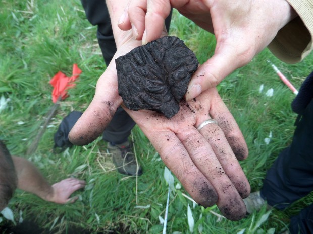
Slag exposed in test pitting at High Stott Park, Windermere

Slag exposed in test pitting at High Stott Park, Windermere

We have just set up a new blog at Oxford Archaeology North to encompass all of the investigations, (survey, geophysics and excavation) that will be undertaken on the four potential medieval bloomery sites located around Windermere in the coming few weeks. The project is being run in conjunction with The Lake District National Park and the National Trust.

http://windermerebloomeries.wordpress.com/

Oxford Archaeology North logo

A quick note: Back to Windermere this week!

A bloomery mound located at Cinder Nab, Ridding Bay on Windermere

A bloomery mound located at Cinder Nab, Ridding Bay on Windermere

After an enforced absence posting on here due to the pleasant repercussions of a new addition to the family, it is my pleasure to start posting again, starting with my first volunteer-orientated project of the year. We are going back to Windermere for the next few weeks for a fourth and final season of archaeological work as part of the Windermere Reflections Project. Again this is in conjunction with the Lake District National Park and the National Trust. For this year we are going to be exploring the theme of metal, and we shall be investigating four separate medieval or later iron production sites, called ‘bloomeries’ that are located around the lake.

I will be undertaking the field survey element of the project with the volunteers of the four sites, which are at High Stott Park; Cinder Nab/Riddings Bay; Ghyll Head and Blelham Tarn. As part of the project we will also be doing some geophysical surveys, and a small excavation of the latter site, which has the potential to be a more complex water-powered bloomsmithy.

Contour data for Cinder Nab, Windermere

Contour data for Cinder Nab, Windermere

The Fairfield Iron Mine, at Tongue Gill, near Buttermere

Volunteers surveying the lowest spoil heap and working area at Fairfield iron mine in 2013

Volunteers surveying the lowest spoil heap and working area at Fairfield iron mine in 2013

This is the third of my posts on the mining sites we have explored and surveyed in 2013 for the Windermere Reflections Project, and it concerns the Fairfield iron mine which is located at the northern end of Grasmere.

In the late nineteenth century this mine, in tandem with the more northerly Providence iron mine, formed the contemporaneously worked Tongue Gill Mines. The mine exploited a north-west/south-east orientated haematite ore vein in the Borrowdale volcanic rock that dipped to the south-west. running through the area of Great Tongue on the western flank of Fairfield mountain.

Location of Providence and Fairfield iron mines at Tongue Gill, near Grasmere

Location of Providence and Fairfield iron mines at Tongue Gill, near Grasmere

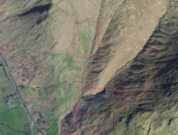
Google Earth image of Tongue Gill near Grasmere, with Fairfield and Providence iron mines highlighted

Google Earth image of Tongue Gill near Grasmere, with Fairfield and Providence iron mines highlighted

An agreement, dated 1693, to supply iron ore for nine years from pits in Grasmere (LRO DDSA 38/2)

An agreement, dated 1693, to supply iron ore for nine years from pits in Grasmere (LRO DDSA 38/2)

The mining literature recorded both Tongue Gill mines as being worked around 1700 to supply ore to a furnace in Great Langdale. The only possible piece of evidence uncovered for pre-nineteenth century workings was an agreement dated 1693 which detailed Henery Rooper, a miner of Grasmere who was to supply Myles Sandys, of Hawkshead, (an individual associated with Cunsey Forge on the southern end of Windermere) with iron ore for nine years. No recognisable locations for the iron ‘pits’ in Grasmere were identified through the agreement and in any case the agreement was not enacted upon, but this surviving document may point to other such agreements/leases held in this period by other parties to mine iron ore in Grasmere. In addition, samples of haematite recovered at Cunsey forge during excavations undertaken in 2003 were consistent with known occurrences in the Grasmere area.

At Fairfield Mine, the mine layout is more complex than that at Providence mine which suggests some longevity of working although the documented history of the mine is relatively short-lived. Identifiable documents coincide with the 1870s boom in iron prices; in 1872 Thomas Dineen a man of Irish extraction, who was a rivet and bolt manufacturer and iron merchant from Workington, acquired a take note for one year with an option for a 21-year lease for the mine sett. His tenure was unsuccessful, indeed when he first visited the site in 1873 it was said that he couldn’t even find it.
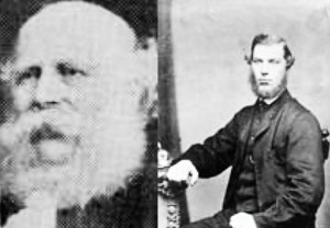
Messrs Morgan and Waide of the Lake District Haematite and Mining Co. (© Rotherham Libraries, Museums and Archives)

Messrs Morgan and Waide of the Lake District Haematite and Mining Co. (© Rotherham Libraries, Museums and Archives)

On the 19th September 1874 the lease was taken up by the newly formed Lake District Haematite and Mining Co., that was set up by a group of Rotherham and Sheffield businessmen, presumably to feed raw materials for their other ventures. The mine agent 1873-1877 was John Hall, a skilled mining engineer from Alston. The directors included an alderman of Rotherham, James Clifford Morgan, and his colleague Francis William Waide, who were partners in the company of Morgan, Macaulay, and Waide a stove grate manufacturers, general iron founders and merchants, located at Baths Foundry in Rotherham.

The mineral statistics of 1874 show that 204 tons of ore had been raised, valued at £350 (along with the ore from Providence mine) but with the slump in the price of iron in the following year the mine was evidently in trouble. In total both Tongue Gill mines together raised 1,300 tons of ore (or 1500 tons in the other later secondary sources) in this short-lived period. By at least December 1875 the venture was in trouble and a pleading letter was sent by the company to the mineral agent asking for the unpaid rent on the mine to be waived due to the amount of development the company has undertaken on the mine.

The company failed to post accounts and a list of shareholders to the Register of Joint Stock Companies, as required by law. In 1877 the angry and unpaid chief mine agent John Hall took the named directors to court in Rotherham for unpaid wages and other liabilities. The directors counter-claimed that they had been conned into investing in a worthless mine, and eventually the company was liquidated. In part the fiasco eventually led to the financial ruin of Mr Waide but Alderman Morgan became mayor of Rotherham the following year followed by a comfortable retirement. The mine was recorded in the mineral statistics as being owned by the Lake District Haematite and Mining Co. Ltd from 1877 –1882 but it was standing idle.

The surviving layout of the mine consists of three adits driven south-east into the hillside that run gently upslope following the course of the south side of Tongue Gill for over 150m. The ruins of mine buildings, and dressing floors/working areas are concentrated around the lowest adit on the western end of the site.

Overall survey drawing of the Fairfield iron mine, at Tongue Gill, near Grasmere

Overall survey drawing of the Fairfield iron mine, at Tongue Gill, near Grasmere

Some of the earliest mining remains surveyed at Fairfield comprise the series of well-defined earthworks of inter-connected hushes that run downslope from Rydal Fell to Tongue Gill. The main hushing runs south-east/north-west down to the gill and is partially overlain by an enclosure wall. There is a cross-cutting hush running along the slope that would have channelled water from at another hush and at least one hushed tributary stream. These hushes would have been used to chase surface evidence of the ore vein and to identify its orientation; it is possible that they predated the 1870s exploitation of the mine.

A linear hush running down the mountainside at Fairfield iron mine

A linear hush running down the mountainside at Fairfield iron mine

On the edge of Tongue Gill, just to the west of the hushings, is a series of shallow surface trial workings running into the stream where ore nodules were visible in the stream bed and banks. There are two more pronounced deep cuttings running into the stream and the westernmost cutting is an almost vertical rectangular cutting which was either chasing the ore vein or has been stoped-out to extract ore near the ground surface.

The easternmost trial adit  is potentially late-nineteenth century in origin, and there is a vertical quarried rock face on the footpath west of the trial adit where drill marks show it has been excavated using blasting technology.

The central of the three adits at Fairfield  lay above the stopes and surface workings in the centre of the complex. The size of the spoil heap may point to this adit also having been purely a trial level.
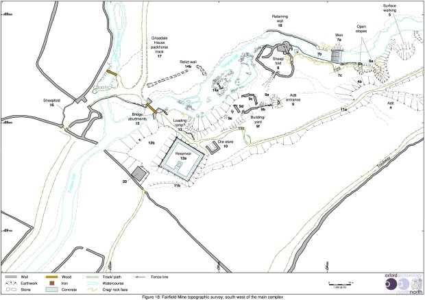
Survey drawing of the main area of working at Fairfield iron mine, at Tongue Gill, near Buttermere

Survey drawing of the main area of working at Fairfield iron mine, at Tongue Gill, near Buttermere

The main focus for Fairfield mine is the lowest adit located on the western end of the complex. There are a series of features surrounding the adit, including a large spoil heap, a yard/working area and a possible ore store. The adit itself is partially blocked at the entrance and was not investigated underground. Tyler recorded that the adit was 6ft 6ins high by 4ft 6ins wide and extended into the hillside for over 160 yards before a roof collapse at the start of the stoping had closed it. A small trial of a subsidiary north/south orientated stringer of ore was recorded 60 yards from the entrance.

View along the top of the spoil heap/working floor at the lower mine adit of Fairfield iron mine

View along the top of the spoil heap/working floor at the lower mine adit of Fairfield iron mine

There is an extensive spoil heap running west from the adit entrance that spills steeply down onto Tongue Gill. The flat top would have been used for ore dressing and adjacent to the adit mouth is a partially collapsed rectangular year/storage area consisting of two short sections of walling. This yard has evidently not been roofed as a structure and here is a small gap between the yard and the retaining wall that define the south side of the working area which would have originally provided a gap for narrow gauge rails to pass by. At the southern end of the spoil heap are fragmentary remains of a walled loading ramp/bay, similar to that at Providence Mine and adjacent to it is a collapsed ore store.
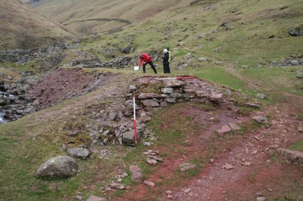
A loading ramp on the southern end of the lower spoil heap/working floor of Fairfield iron mine

A loading ramp on the southern end of the lower spoil heap/working floor of Fairfield iron mine

On the westernmost edge of the complex is a roofed bothy structure located adjacent to an enclosure wall at the entrance where an access trackway would originally have extended up to the mine. The bothy should probably be associated with miner’s accommodation/shelter as it evidently predated the construction of the nearby reservoir. Other features to note are the trackways running through the complex and the large bridge piers constructed across Tongue Gill.

A large uncovered reservoir built for Grasmere Urban District Council, was constructed on top of the mine complex but apparently does not seem to have done much lasting damage to the site. There is an associated weir located upstream on Tongue Gill where water was piped down to the reservoir.
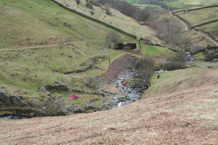
View looking west downstream at the lower workings of Fairfield iron mine

View looking west downstream at the lower workings of Fairfield iron mine

The character of the working at Fairfield and Providence is comparable to the other boom period mining sites. Both Providence and Fairfield mines reflect a brief period of intense mining activity fuelled by high prices for ore, and accords with a number of other operations elsewhere in Cumbria. The decline in both cases was prompted by the slump in iron ore prices in 1875, and that was in itself prompted by the over production of iron ore across the region. Being operational for only a few years they demonstrate single phase integrated workings and as such provide an opportunity to examine the workings process of the late nineteenth century. The extensive hushes, small stoped workings and surface extraction at Fairfield iron mine may, however, have been undertaken in an earlier undocumented period of activity.

The Providence Iron Mine at Tongue Gill, near Grasmere

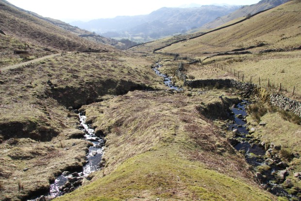
View south along Little Tongue Gill towards Grasmere, from the drainage adit spoil heap at Providence iron mine

View south along Little Tongue Gill towards Grasmere, from the drainage adit spoil heap at Providence iron mine

For this the second of my occasional posts on the mining sites we have explored and surveyed in 2013 for the Windermere Reflections Project, I will concentrate on the Providence iron mine which is located at the northern end of Grasmere.

In the late nineteenth century this mine, together with the more southerly Fairfield iron mine, formed the contemporaneously worked Tongue Gill Mines. The mine exploited both a north-west/south-east and a north/south orientated haematite ore vein in the Borrowdale volcanic rock running through the area of Great Tongue on the western flank of Fairfield mountain.

Google Earth image of Tongue Gill near Grasmere, with Fairfield and Providence iron mines highlighted

Google Earth image of Tongue Gill near Grasmere, with Fairfield and Providence iron mines highlighted

Prior to the nineteenth century the mining literature had both Tongue Gill mines recorded as being worked around 1700 to supply ore to a furnace in Great Langdale. However, it was the short lived boom in the early to mid-1870s that prompted the opening (or re-opening) of many mines across the region and saw a massive, and very intensive period of iron extraction. This was fuelled by an increase in the value of iron ore when the price of iron rocketed from 13s to £1 12s per ton, and many entrepreneurs across the region were keen to take advantage of this opportunity.
Surveying at Providence iron mine, near Grasmere in 2013

Surveying at Providence iron mine, near Grasmere in 2013

It is within this context, that we see the documented short-lived but intensive activity at the Tongue Gill mines of Grasmere. The Providence Mine was opened by the Providence Iron Co Ltd in 1873 and was worked by them until 1876, with the chief agent being John Muse, a successful miner from Alston. The mine was excavated to exploit a 16ft thick vein of solid haematite and the mine posted mineral statistics for 1874 for 300 tonnes of ore extracted which was valued at £350 along with the ore from Fairfield mine. The success was short lived due to fractured and unstable ground conditions, high transport costs due to a lack of a nearby railhead, and a declining market for iron from 1875 onwards. The mine was acquired by John Muse himself in 1877 as part of John Muse, J Straughton, Ashton and Co. who also ran the successful Force Crag mines, but the mineral statistics show that it stood idle between 1877-82. The brief documented history for Providence Mine in this period is relatively simple, and the straightforward surface layout of the mine would suggest that most features were associated with this short-lived episode of exploitation.

Overall survey drawing of the Providence iron mine, at Tongue Gill, near Grasmere

Overall survey drawing of the Providence iron mine, at Tongue Gill, near Grasmere

The surface layout for Providence Mine is separated into two distinct zones, with evidence for the majority of the features at the upper workings in the north-west of the site and with smaller lower workings in the south-east. The upper workings  consist of various extractive areas beneath a collapsed vertical shaft at the summit of the mine. There are several adits, trial scoops and a hushed channel with spoil heaps straddling the outer enclosure wall and clustering along the course of a small tributary stream of Little Tongue Gill. This stream was undoubtedly where the prospecting for an ore vein was undertaken along the stream bed as it climbed upslope and iron staining is visible as far up as 1700ft in the stream bed. At the foot of the upper workings there is a walled loading ramp on the side of an access trackway that runs away from the mine, towards the lower workings and a junction with the Grisedale Hause packhorse route.

Loading ramp at the upper workings, Providence mine, Grasmere

Loading ramp at the upper workings, Providence mine, Grasmere

Separate from this zone, at the lower workings, thee is a single collapsed adit with spoil heap located further downslope adjacent to Little Tongue Gill and near to the Grisedale Hause packhorse route. The adit may have functioned to drain the upper workings of the mine; it would have provided an easier haulage level to bring ore out rather that winding it up the top shaft, or transporting it further from the upper workings.

The collapsed lower drainage adit - Providence iron mine

The collapsed lower drainage adit – Providence iron mine

The most unexpected feature encountered on the survey was a large oval scooped stock enclosure, which, would typically have been of prehistoric/Iron Age in date. It has a well-defined kerbed entrance on the east side and would have corralled cattle at the foot of Great Tongue, where trampling and the extraction of manure from the centre has created a scooped effect. The location of any round house within the site would have been in the south-west corner where there is a small flattened area, but there is no other surface evidence for it.

A scooped prehistoric stock enclosure at Tongue Gill, Grasmere

A scooped prehistoric stock enclosure at Tongue Gill, Grasmere

Windermere Reflections Community Archaeology 2012 – Fulling mills survey report online

Montage of volunteers surveying on the Windermere Reflections project 2012

Montage of volunteers surveying on the Windermere Reflections Project in 2012

As part of the 2012 season of community archaeology survey for the Windermere Reflections project, the Fulling mills survey report is now available online at the OA Library.
Just to recap I have already posted on the fieldwork for this season of the project in 2013. As part of the 2012 field season we collaborated with the National Trust and the Lake District National Park Authority on a community archaeology project using local volunteers to survey a series of five fulling mill sites. These were each located in the water catchment area of Windermere Lake in the Lake District. The project was intended to undertake a series of detailed topographic surveys and desk-based analyses of the potential ruinous fulling mills sites while providing support and training for volunteers in areas such as archaeological survey and archive research.

Volunteers doing both plane table and theodolite surveying at Sourmilk Gill, Easedale

Volunteers doing both plane table and theodolite surveying at Sourmilk Gill, Easedale

The project was financed by the Heritage Lottery Fund and was one of three community archaeology surveys that have been undertaken in the last two years under the banner ‘Reflections on History’ as part of a wider range of conservation and heritage themed projects under the umbrella of ‘Windermere Reflections’ for the Windermere Catchment Restoration Programme.

Windermere Reflections Logo

Topographic survey was undertaken between the 9th April and 5th May 2012 to identify, record, and describe any extant structures and features associated with the possible fulling mills. Desk-top historical survey of information pertinent to each site, including historical maps, and records held in the Armitt Library and Kendal Record Office took place on the 9th and 10th May 2012.

Drawing of a fulling mill taken from Theatrum Machinarum Novum (1661)

Drawing of a fulling mill taken from Theatrum Machinarum Novum (1661)

Fulling describes the process of cleaning and de-greasing woollen cloth, either with potash, dung and urine or fuller’s earth, and the pounding of the cloth to compact the fibres of the fabric. The pounding of the roughly woven woollen cloth was undertaken using large wooden hammers (known as stocks) which were lifted by cams on an axle turned by a water wheel. The stocks would act upon the cloth within a large fulling trough which also contained water and fuller’s earth. After fulling, the cloth would be washed, stretched and dried.

Location map of the five fulling mill sites investigated in 2012

Location map of the five fulling mill sites investigated in 2012

Four of the five sites examined by the survey are located within the northern part of the catchment, near the villages of Grasmere and Langdale, an area documented as important for fulling and weaving. The condition of the mills was variable, with one at Sourmilk Gill being an exceptional survival and representing an archetypal medieval fulling mill, whereas at Loughrigg Terrace, for example, there is reasonable survival of the water system but the mill remains are open to interpretation. Two of the mills, that at Sourmilk Gill and Stickle Ghyll, were originally stone founded structures, associated with well-defined water supply systems, comprising head race, wheel pit and tail race, and, at Sourmilk Gill, a launder platform also. Both mill structures were potentially reused and their operational life is uncertain.

Detailed topographic survey drawing of the Sourmilk Gill fulling mill

Detailed topographic survey drawing of the Sourmilk Gill fulling mill

At Loughrigg Terrace, the putative mill platform is only 4.5m by 2.6m in size and it is possible to conjecture that the stocks and trough would not have been contained within a building, although a simple timber structure could have been erected over the working components. There would, in any case, have only been room for a single stock hammer and trough.

Foundation remains of the fulling mill and race at Sourmilk Gill, Easedale

Foundation remains of the fulling mill and race at Sourmilk Gill, Easedale

The head and tail races were the most diagnostic features of all the mills, and often provided the most definitive evidence for a mill, notably at Loughrigg Terrace. The relatively limited water supply for many of these water wheels indicates that the supply would have been taken over the top of an overshot wheel (as opposed to an undershot wheel which required a large flow of water) using a wooden launder. These rarely survive; but a large stone platform for a launder survives at Sourmilk Gill.

Surveying the mill pond in Low Wood, Elterwater

Surveying the mill pond in Low Wood, Elterwater

At three of the mill sites (Sourmilk Gill, Low Wood and Little Ore Gate) a series of ponds survived, which drew water from a divert channel, although their function as part of the fulling process were potentially varied.

The process of fulling was bound into a broadly agricultural economy of mixed farming, including the rearing of sheep and shearing, as well as weaving and potash manufacture. Spatially associated with a number of the mills were stock pounds, arable farming remains and potash kilns, which reinforce the historical evidence that indicates that fulling was undertaken on a part-time basis alongside a large range of agricultural activities and was seasonal following on from the annual wool shear typically in mid-summer.

Gazebo malfunction at Loughrigg Terrace, by the side of Grasmere Tarn

Gazebo malfunction at Loughrigg Terrace, by the side of Grasmere Tarn

Special thanks must go to all of the volunteers who participated on the five survey projects, especially for their fortitude in ofter trying weather conditions.

Community Archaeology Surveys – Windermere Reflections 2013

Volunteers on Windermere Reflections

Volunteers on the Windermere Reflections 2013 surveys

In April and May 2013 we collaborated with the National Trust and the Lake District National Park Authority on a community archaeology project using local volunteers to survey a series of four mining sites and quarries. These were each located in the water catchment area of Windermere Lake in the Lake District.

This post provides an overview of the project but I will add further individual posts in due course describing in detail what was found at each of the mining and quarry sites. Special thanks must go to all of the volunteers who participated on the four survey projects in spite of the unseasonably cold snowy weather.

Surveying using a theodolite with attached disto

Surveying using a theodolite with attached disto

The project was intended to undertake a series of detailed topographic surveys and desk-based analyses of former mines and quarries, while providing support and training for volunteers in areas such as archaeological survey and archive research.

Teaching volunteers how to use a survey grade GPS at Fairfield iron mine, Grasmere

Teaching volunteers how to use a survey grade GPS at Fairfield iron mine, Grasmere

This year topographic survey was undertaken to identify, record, and describe any extant structures and features associated with four mines and quarries within the Windermere lake catchment: Banks Quarry, near Elterwater (NY 3147 0432); Greenhead Gill Mine, Grasmere, (NY 3497 0864); Fairfield Mine, Grasmere (NY 3400 0980); and Providence Mine, Grasmere (NY 3390 1050).

Windermere_location_fig

The Windermere Catchment Mining Sites

The project was financed by the Heritage Lottery Fund and was one of three community archaeology surveys that have been undertaken in the last two years under the banner ‘Reflections on History’ as part of a wider range of conservation and heritage themed projects under the umbrella of ‘Windermere Reflections’ for the Windermere Catchment Restoration Programme. The theme for the 2013 surveys was ‘stone’ so we looked at extractive industries. Last year we undertook two separately themed surveys, the first for ‘wood’ so we surveyed woodland industry sites, and the second for ‘water’ so we looked at water powered fulling mill sites in the catchment.

Windermere Reflections Logo

The surveys were undertaken between the 8th April and 3rd May 2013. Desk-top historical survey of information pertinent to each site, including historical maps, and records held in the Armitt Library and Kendal Record Office took place on the 8th and 10th May 2013.

Banks Quarry is a representative example of slate working sites that are prevalent across the Coniston and Langdale valleys. These are characterised by the outcropping of the Borrowdale Volcanic Series (BVS) rocks that provided the characteristic green slates. The rock was won from open quarries or adits following a narrow seam of good quality rock, and there were many separate quarry and processing areas concentrated in a localised area each working a different part of the same seam. At the entrance to the adits or quarries were a series of riving sheds where the coarse rock was cleaved into thin roof slates. Much of the rock that was quarried, however, was discarded producing considerable spoil which extended over earlier workings.

Volunteers surveying a quarry building at Bank's Quarry, Elterwater

Volunteers surveying a quarry building at Bank’s Quarry, Elterwater

The Greenhead Gill mine complex is one of the most important early lead working sites in Cumbria and is located in a narrow isolated ravine-like valley. It has two separate processing areas about 140m apart on the east side of Greenhead Gill. The documentary and archaeological evidence points to at least two separate phases of exploitation at the mines on Greenhead Gill, the first was the relatively short-lived Elizabethan workings, which were one of several trial workings established around Grasmere. Then in the late-nineteenth century the original workings were reworked and exploratory working was undertaken to the south of the main complex using drilling and powder-blasting technology.

The uppermost of two Elizabethan coffin levels located on Brackenfell, near Grasmere

The uppermost of two Elizabethan coffin levels located on Brackenfell, near Grasmere

Providence and Fairfield iron mines each reflect a brief period of intense mining activity fuelled by high prices for ore, and accords with a number of other operations elsewhere in Cumbria. Being operational for only a few years they demonstrate single phase integrated workings and as such provide an opportunity to examine the workings process of the late nineteenth century.

Volunteers surveying a yard and working floor at Fairfield iron mine, Grasmere

Volunteers surveying a yard and working floor at Fairfield iron mine, Grasmere