A training weekend was undertaken on the first weekend in September supervised by myself and Gemma Stewart, the Northumberland National Park Community Archaeologist, to survey a stone row alignment located on the open moorland at Standingstone Rigg, near Simonburn, Northumberland.
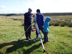
Training volunteers to use a theodolite
The project was funded through Northumberland National Park to enable volunteers to undertake practical archaeological projects within the National Park. The aim of the project was to provide appropriate professional supervision and training in order to build the capacity of local groups to actively research little studied or poorly understood elements of the archaeology of the National Park.
The survey falls under the wider umbrella of the Heritage Lottery Funded Altogether Archaeology Project, a multi-period community archaeology project being undertaken to record archaeological sites in the North Pennines AONB and beyond.
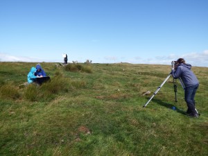
Theodolite recording in progress
The field survey aimed to build upon preliminary survey work carried out in 2012 by Phil and Anne Bowyer, and train volunteers in various survey techniques to create a series of detailed plans of key features associated with the stone row.
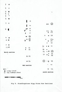
Phil and Ann Bowyer 2012 sketch plan of the stone row
The stone row was surveyed using a combination of a theodolite and disto technology to create a manual measured plan of the stones and a differential GPS to record surrounding structures and archaeological features. All upstanding and recumbent stones from the row were measured, described and photographed.

Northern end of the stone row, looking north
Preliminary results of the survey revealed a slightly sinuous NNE/SSW double alignment of both upstanding and recumbent stones that ran upslope over the crest of a ridgeline and down the other side, adjacent to one, or possibly two funerary cairns on the crest of the ridge. The stones have packing stones surrounding them and in the centre of the alignment it is often just the packing stones that survive as the standing stones have been removed for building a nearby sheepfold. The size of the stones does seem to follow the broad pattern of larger examples nearer the crest of the ridge in the north end of the alignment, and it is clear that the sandstone bedrock has been hewn and cleaved up along natural bedding planes often immediately adjacent to where the stones now stand.

Northern end of the stone row, looking south
The southern end of the stone row continues as an alignment of ten pits surviving as part-filled sunken features before it probably disappears into a boggy area to the south. The double stone row is a prehistoric monument usually dating from the later Neolithic or Bronze Age, and this example is a very rare, if not unique surviving example from Northumberland. In the British Isles sinuous double stone rows which meander across open moorland countryside are more typically associated with the Dartmoor area.

Southern end of the stone row, looking south
These types of monuments are often found in association with other features such as funerary cairns, which is also possibly the case at our example, but so far I have not been able to identify any other stone rows associated with an extant pit alignment.
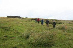
Pit alignment on the southern end of the stone row

Hexacopter survey at Standingstone Rigg
When the bad weather abated the week after the survey weekend, my manager Jamie Quartermaine returned to site with Gemma and Phil to survey it using his Hexacopter. This is a small remote-controlled helicopter that can be used (in light winds) to take aerial photography of archaeological sites. The data was processed in Agisoft software to create both a composite photograph of the stone row and a 3D model of the site.
Hopefully when the final results of the project are published the weekend training exercise will have added significantly to our knowledge of the prehistory of Northumberland National Park, and it will have given local volunteers practical skills for recording further monuments in this landscape in the hinterland north of Hadrian’s Wall.
Particular thanks are due to Gemma Stewart for making the project possible, Phil and Anne Bowyer who have been doing so much background work to understand the archaeology of the surrounding landscape (forthcoming Ravensheugh Crags blog post), and the volunteers from Altogether Archaeology and members of Tynedale Archaeology Group who braved the inclement weather. Thanks are also due to the tenant farmer at Great Lonbrough farm and the Nunwick Estates. A special mention should also be given to Stan Beckensall who braved the rain on the Sunday to help survey the stones.

Agisoft plot of the aerial photography at the stone row


